Garmin
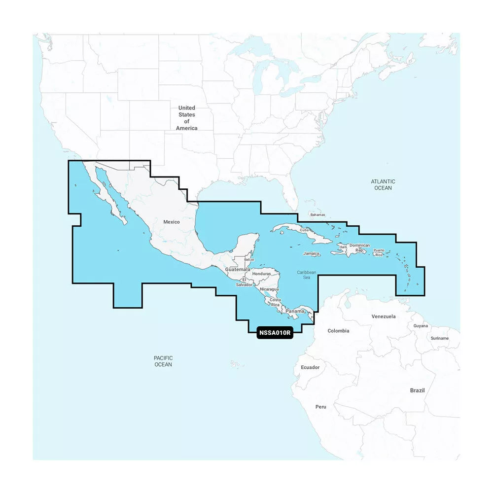
Navionics+ NSSA010R Central America & Caribbean
Navionics+ NSSA010R Central America & Caribbean
SKU:010-C1451-20
Pre-Order
Description & Specifications
Navionics+™ NSSA010R Central America & Caribbean
Featuring vibrant colors, a streamlined interface, and combined coastal/inland content with a popular Navionics® style color palette, Garmin Navionics+ cartography makes it easy to plot courses with the world’s No. 1 name in marine mapping.
- microSD™/SD™ format
- Navigate with the best offshore and inland lake coverage for a Garmin chartplotter
- Customize the view with various chart layers and overlay combinations
- With the included one-year subscription, access daily updates via the ActiveCaptain® smart-device app
- Auto Guidance+™ technology2 lets users navigate with suggested dock-to-dock routings
- Select up to 10 color-shaded target depth ranges to scope out the best fishing spots
- Save money by renewing the subscription — and continue accessing daily updates plus new content downloads
Coverage
Detailed coverage of the west coast of Mexico from Tijuana to Panama. Including the Panama Canal in its entirety. East Coast coverage from Panama to Brownsville, TX. Also includes detailed Caribbean coverage of the Far Bahamas, Turks & Caicos, Cuba, Jamaica, the Caymans, Haiti, the Dominican Republic, Puerto Rico, and the Lesser Antilles to Grenada.
All-In-One Map Solution for Garmin Chartplotters
Access detail-rich mapping of coastal features, lakes, rivers, and more. Integrated Garmin and Navionics® content offers coverage for boaters worldwide.
Daily Chart Updates
Charts are constantly being enhanced with new and amended content — as many as 5,000 updates are made every day. The one-year subscription includes access to daily chart updates via the ActiveCaptain app.
Auto Guidance+ Technology
Combining the best of Garmin and Navionics automatic routing features, built-in Auto Guidance+ technology2 gives users a suggested dock-to-dock path to follow through channels, inlets, marina entrances, and more.
Depth Range Shading
High-resolution depth range shading lets users select up to 10 color-shaded options and view the designated target depths at a glance.
Up to 1’ Contours
For improved fishing and navigation, up to 1' contours provide a clear depiction of bottom structure for improved fishing charts and enhanced detail in swamps, canals, harbors, marinas, and more.
Shallow Water Shading
To give a clear picture of shallow waters to avoid, this feature allows for shading at a user-defined depth.
Raster Cartography
NOAA raster cartography3 is available for some U.S. waters as a free downloadable feature via the ActiveCaptain app to provide paper chart-like views on a plotter.
ActiveCaptain Community
Community-sourced content provides useful POIs, such as marinas, anchorages, hazards, businesses, and more. Get recommendations from boaters with firsthand experience of the local environment.
⚠️ IMPORTANT NOTE:
Product dimensions are subject to change without prior notice due to updates in manufacturer safety guidelines and standards. As a result, the size of the product delivered may vary slightly from the specifications provided at the time of order. We recommend reviewing the latest information before purchase to ensure compatibility. This policy is in place to prioritize your safety and the quality of our products.
Product images are for illustration purposes only and may vary based on your monitor’s resolution. Actual colors and details of the product may differ from what is displayed. Please consider this when making your purchase.
Share