Garmin
Standard Mapping® - Louisiana Central Premium MicroSD™/SD™ Card
Standard Mapping® - Louisiana Central Premium MicroSD™/SD™ Card
SKU:010-C1169-00
Pre-Order
Description & Specifications
Garmin Standard Mapping® - Louisiana Central Premium microSD™/SD™ Card Product Description
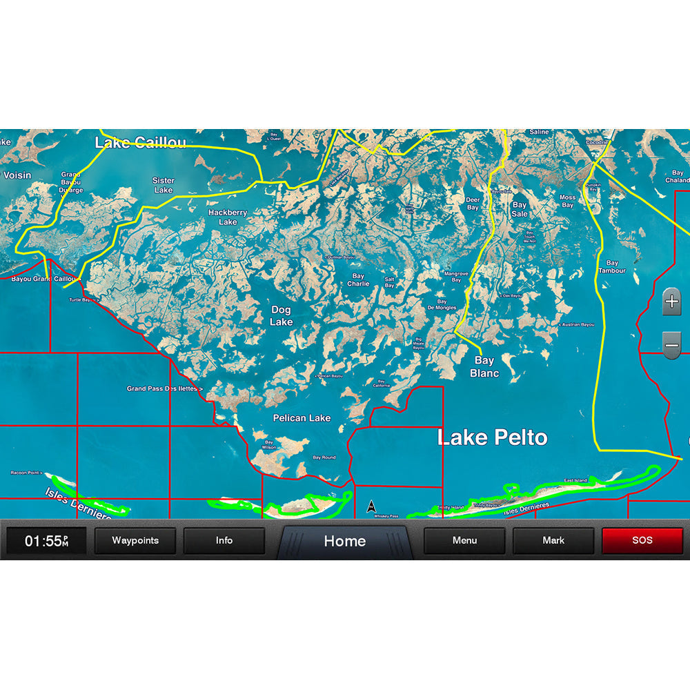
Sectioned coastal aerial overlay provides high-resolution imagery, local names of waterways and land features plus outlined Wildlife Management Areas and Offshore Lease Areas.
Garmin 010C116900 Attributes
- Compatibility: Compatible With Chart Plotters
- Chart Coverage: Louisiana Central Premium
- Storage: On SD/ Micro-SD Card
Garmin 010C116900 Features & Benefits
- Identifies Offshore Field Lease Blocks Outlined In Red With White Labels
- Recommended Routes - Yellow Lines Identify A Highway System Through The Marsh, Created By Standard Mapping
- Outlines Wildlife Management Areas In Green
- Provides Coverage Of Louisiana Central
- Limited One Year Consumer Warranty
Garmin 010C116900 Warranties
Standard Mapping® - Louisiana Central Premium microSD™/SD™ Card
Statewide coastal aerial overlay provides high-resolution imagery, local names of waterways and land features plus outlined Wildlife Management Areas and Offshore Lease Areas.
Offshore Field Lease Blocks
Identifies offshore field lease blocks outlined in red with white labels.
Recommended Routes
Yellow lines identify a highway system through the marsh, created by Standard Mapping.
Wildlife Management Areas
Outlines these areas in green.
⚠️ IMPORTANT NOTE:
Product dimensions are subject to change without prior notice due to updates in manufacturer safety guidelines and standards. As a result, the size of the product delivered may vary slightly from the specifications provided at the time of order. We recommend reviewing the latest information before purchase to ensure compatibility. This policy is in place to prioritize your safety and the quality of our products.
Product images are for illustration purposes only and may vary based on your monitor’s resolution. Actual colors and details of the product may differ from what is displayed. Please consider this when making your purchase.
Share